
.png)
.png)
.png)
.png)
.png)
.png)
.png)
.png)
Upper Mustang Trekking Overview
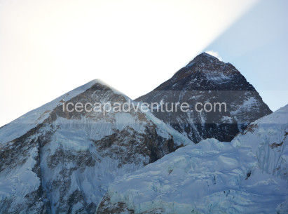
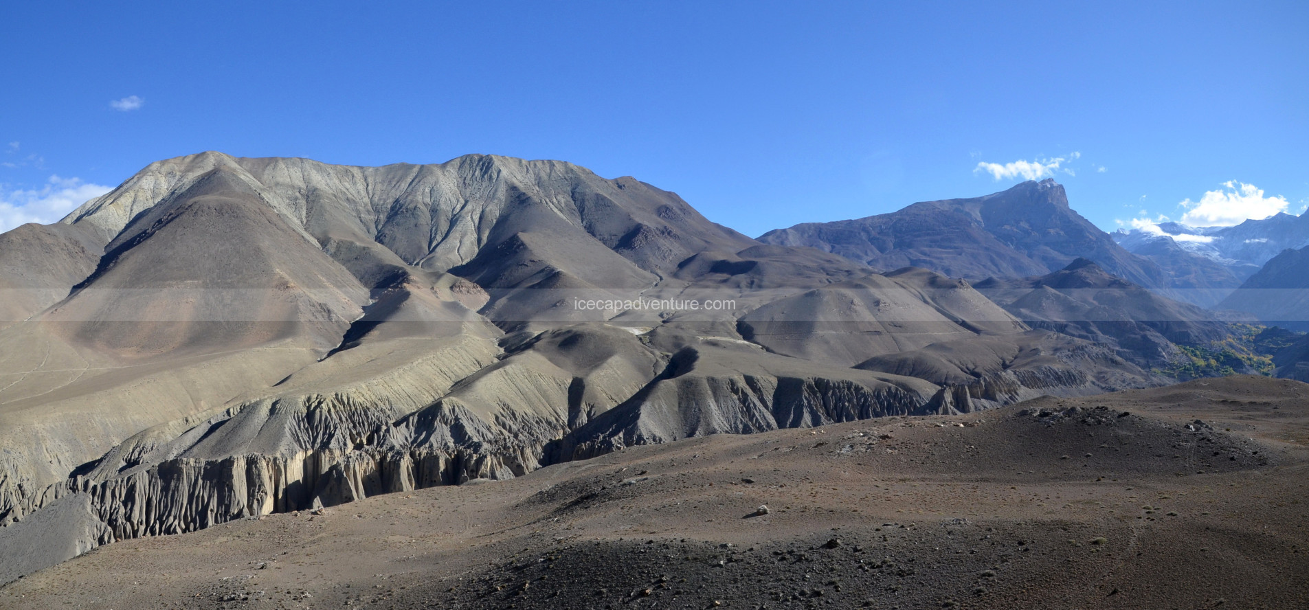
Upper Mustang Trekking is one of Nepal’s most fascinating journeys, taking trekkers into the remote Himalayan desert once known as the “Last Forbidden Kingdom.” Restricted to outsiders until 1992, this region still feels like stepping back in time, where Tibetan culture, ancient monasteries, and traditional lifestyles remain beautifully preserved. Nestled beyond the Annapurna and Dhaulagiri ranges, Upper Mustang lies in the rain shadow of the Himalayas, offering dry, dramatic landscapes that stand in sharp contrast to Nepal’s lush green valleys.
Landscapes and Wildlife
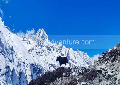
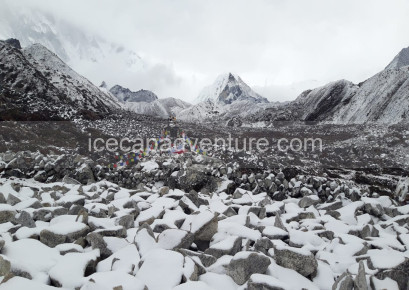
The terrain is strikingly unique—wind-eroded cliffs, red and brown canyons, barren ridges, and the deep Kali Gandaki Gorge, the world’s deepest. The journey passes through whitewashed villages, caves carved into cliffs, and high-altitude deserts that resemble Tibet more than the rest of Nepal. While wildlife is not as diverse as in forested areas, trekkers may encounter blue sheep, Himalayan marmots, and soaring eagles against the stark backdrop.
Trekking Experience
The trek is graded moderate, with trails that are less steep than high-mountain passes but long and exposed. Altitudes reach over 3,800 meters in Lo Manthang, the legendary walled capital of Mustang, where palaces and monasteries tell stories of a once-thriving kingdom. The biggest challenges are the strong winds and dry climate, but the cultural and scenic rewards are unmatched.
Best Seasons to Visit
Upper Mustang can be trekked year-round due to its location in the rain shadow. Unlike other regions, it is ideal even in the monsoon (June–August) when skies are clearer here. The most popular times, however, remain spring (April–May) and autumn (September–November) for comfortable weather and vibrant festivals.
Cultural Significance
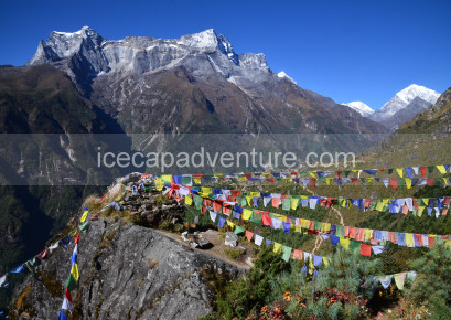
Upper Mustang is deeply influenced by Tibetan Buddhism. Monasteries, prayer flags, and chortens mark the trail, while the famous Tiji Festival in Lo Manthang draws pilgrims and trekkers alike. The trek offers not just stunning landscapes but also an immersion into one of the Himalaya’s most authentic cultural strongholds.
1
We will be waiting to welcome you at Tribhuvan International Airport, Kathmandu, where you will be greeted with a traditional Nepali flower garland to mark your arrival. After the warm welcome, we will drive you to your hotel—approximately 30 minutes during the day and 20 minutes at night.
Upon reaching the hotel, you will be offered welcome drinks and biscuits, followed by the settlement of your rooms. Once settled, please join us back in the lobby or meeting hall for a briefing about your trekking and tour program on the Upper Mustang Trek, including an introduction to your trekking guide and other relevant details. After the briefing, you will have the opportunity to check your trekking equipment with your guide.
Note: If you arrive in Kathmandu at night, these activities will be scheduled for the following day after breakfast and meals.
2
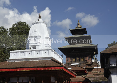
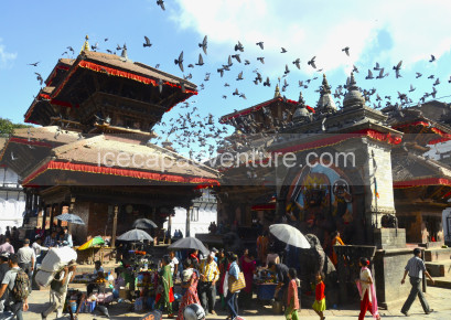
After breakfast at the hotel, You will have time to explore Kathmandu’s cultural heritage sites such as Kathmandu Durbar Square, Swayambhunath (Monkey Temple), or Boudhanath Stupa and you will have the day to prepare for your trek.
Our team will assist you in checking your gear and ensuring you have all the necessary equipment for the journey ahead. If you need to buy or rent any trekking gear, we will guide you to the best shops in Thamel, where you can find quality items at reasonable prices.
In the evening, your trekking guide will conduct a final briefing about the trek, including route details, safety measures, and expected weather conditions. Overnight stay at a hotel in Kathmandu.
3
The scenic drive from Kathmandu to Pokhara takes approximately 6 to 7 hours, covering about 200 kilometers along the Prithvi Highway. This overland journey offers a beautiful introduction to Nepal’s diverse landscapes, winding through lush valleys, terraced rice fields, traditional villages, and alongside the Trishuli and Marsyangdi Rivers. On clear days, travelers are treated to distant views of the Annapurna and Manaslu mountain ranges. The road is mostly paved and in fair condition, though travel time may vary depending on traffic and weather conditions, especially during the monsoon season. Whether traveling by tourist bus, private vehicle, or deluxe coach, the ride provides a comfortable and gradual descent from the busy streets of Kathmandu to the peaceful lakeside city of Pokhara. Known as the gateway to the Annapurna and Upper Mustang trekking regions, Pokhara welcomes visitors with breathtaking views of Machapuchare (Fishtail Peak), serene Phewa Lake, and a relaxed atmosphere that sets the perfect tone for any Himalayan adventure.
Highlights of the Drive:
-
Scenic journey through river valleys and terraced hillsides
-
Views of Himalayan peaks on clear days (Annapurna and Manaslu ranges)
-
Traditional Nepalese villages and local culture along the route
-
Comfortable transport options: tourist bus, private car, or deluxe coach
-
Arrival in Pokhara—the gateway to Annapurna and Upper Mustang treks
4
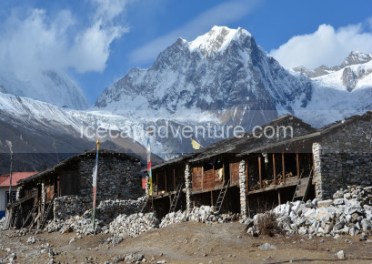
The day begins with a short but spectacular flight from Pokhara to Jomsom, a mountain town located in the Mustang District at an altitude of 2,720 meters. The 20-minute flight offers breathtaking aerial views of the Annapurna and Dhaulagiri ranges, deep river valleys, and dramatic Himalayan landscapes. Upon landing in Jomsom, known for its strong afternoon winds and barren, high-altitude terrain, the trek begins toward the ancient village of Kagbeni. The trail follows the Kali Gandaki River, walking through a wide riverbed with views of arid cliffs, wind-carved rocks, and distant snow-capped peaks. The 4- to 5-hour trek is relatively easy with a gradual ascent, making it an ideal acclimatization day for the days ahead. Kagbeni, a charming medieval village, marks the official gateway to Upper Mustang and is known for its Tibetan-influenced architecture, red-walled monastery, and narrow alleys that echo centuries of history and culture.
Highlights of the Day:
-
Scenic mountain flight from Pokhara to Jomsom (views of Annapurna & Dhaulagiri)
-
Trek along the windswept Kali Gandaki River Valley
-
Spectacular Himalayan desert landscapes and high-altitude villages
-
Arrival in Kagbeni—a traditional village rich in Tibetan culture and heritage
-
First night within the Mustang region, perfect for acclimatization
5
From Kagbeni, the trail climbs immediately to a ridge marked by a small stone chorten, then descends and climbs over other ridges. The trail mostly follows a road above the river along a steep slope. After a few more ups and downs, the trail climbs to a plateau at 3040 m. The trail then drops steeply into a dry riverbed. It’s then a short climb to Tangbe, where you’ll find a tea house on the road above the town. About one hour beyond Tangbe, you will reach the village of Chhuksang at the confluence of the Narshing Khola and the Kali Gandaki. Cross the Narshing Khola and continue north, making several ups and downs. The trek now leaves the Kali Gandaki Valley and climbs steeply up a rocky gully to Chele. The small village boasts several lodges and tea shops.
6
The rest of the trek to Lo Manthang is through high-altitude desert country, climbing in and out of the immense side valleys of Kali Gandaki. The climb from Chele leads up a steep spur to a cairn and a view of Ghyakar across a huge canyon. After crossing the ridge, the trail enters a large side valley and makes a long, gradual descent to Samar, surrounded by a grove of poplar trees. The trail climbs above Samar to a ridge, descends steeply to a stream, then climbs back to a chorten painted in red, yellow, black, and white. The trail goes into another valley filled with stumps of juniper trees that have been harvested for firewood, crosses a stream, and climbs up to the Bhena La.The route skirts a gorge, crosses a stream, and climbs slightly to Yamdo. Climb to yet another pass, the Yamdo La at 4010 m, and descend to Shyangmochen, with good campsites and three tea houses.
7
The trek from Syangbochen to Ghami is a scenic and culturally rich segment of the Upper Mustang journey, taking about 4 to 5 hours to complete. The trail begins with a gradual ascent toward the Yamda La Pass (3,850 m), offering panoramic views of barren valleys, snow-capped peaks, and traditional villages dotting the rugged landscape. You’ll pass by many walls, chortens, and ancient cave dwellings carved into cliffs—all testament to the region’s deep Tibetan Buddhist influence. After crossing the Yamda La, the path undulates through highland pastures and remote hamlets before climbing again to the Nyi La Pass (4,010 m)—the highest point of this trekking day. From here, a steep descent takes you down to Ghami, one of the larger and historically significant villages in Upper Mustang.
Located at 3,520 meters, Ghami is surrounded by dramatic red cliffs and eroded rock formations that give the area a Mars-like appearance. The village itself is an ancient settlement with whitewashed mud-brick houses, and it sits near the longest mani wall in Mustang, stretching across the valley—a spiritually important feature for Buddhist pilgrims. The climate here is dry and windy, especially in the afternoon, so starting early is advisable. This day also helps with acclimatization, as you cross over 4,000 meters before descending to sleep at a slightly lower altitude.
Highlights of the Day:
-
Cross Yamda La (3,850m) and Nyi La Pass (4,010m) with sweeping Himalayan views
-
See ancient cave dwellings, prayer flags, and remote cliff-side monasteries
-
Trek through high-altitude desert terrain, typical of the Tibetan plateau
-
Visit Ghami village, rich in Buddhist culture and traditional Mustang architecture
-
Witness the longest mani wall in Upper Mustang, a spiritual and visual highlight
-
Ideal acclimatization day before heading deeper into Upper Mustang
8
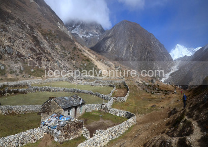
The trail from Ghami turns westward and climbs gently through fields in a broad valley, passing below Chhungar and its imposing chorten. Turning north, it rejoins the road and becomes an unrelated climb across the head of the valley to Nyila. The trail then drops steeply to the whitewashed building of Ghemi. The trail to Drakmar and Lo Gekar leads to the west from the upper part of the village. The charang track descends below the cliff across the valley to a steel bridge. Once over the pass, the route makes a long, gentle descent past a big prayer flag and across the fields to Charang. There is a camping ground behind the hotel, and two others are nearby. The village has a fine entrance chorten, as well as its own electricity supply; you cross under the pipes of the hydroelectric plant just beyond the village.
9
The trail descends about 125 m from Charang, crosses the Charang Chu, and follows the road to a cairn on a ridge opposite the village at 3580 m, then enters the Tholung Valley. The dirt road turns north and climbs gently to the large, isolated Sungda Chorten that marks the boundary between Charang and Lo. The road crosses a stream, then becomes a wide thoroughfare, travelling across a desert-like landscape painted in hues of grey and yellow. Finally, from Lo La, there is a view of the walled city of Lo Manthang.
A short descent leads onto the plain of Aspiration, then the trail crosses a stream and climbs up onto the plateau of Lo Manthang, crossing an irrigation canal at the southern wall of the city of Lo Manthang.
10
Lo Manthang was introduced by the capital of Mustang. There are four major temples within the city walls, each of which is locked. If you can enter the four temples and the Monastic Museum, you can purchase a combined entry ticket. The red 15th-century Thubchen Gompa near the center of the city consists of a massive assembly hall supported by 30 huge wooden columns. After breakfast/lunch, your leader will organize a Jeep for town exploration. Take a walk through the narrow alleyways. Visit the ACAP office in the square in front of the palace. There are numerous shops selling Tibetan-style handicrafts, although virtually all are made in Kathmandu. After visiting the temples in the city, consider hiring a horse to visit some of the other villages in the area.
11
The trail to Lo Gekar is not the main trading route, and the area is criss-crossed with herders’ trails, so a local guide is particularly useful here. The trail climbs steadily to a cairn on a pass at 4000 m, offering a last glimpse of Lo Manthang. Climb to the head of this valley and cross the Chogo La. The trail makes a short, steep descent to a wooden bridge, an unpainted stone chorten, and across a swampy meadow to Lo Gekar. The route crosses some alpine meadows to a crest and then drops down a steep, eroded gully overshadowed by red rock towers to the upper part of Drakmar at 3820 m.
12
The trail descends alongside a stream, passing the stone walls and fields of the extensive village of Drakmar, and then climbs to a ridge at 3710 m. It then descends to another stream and makes a short climb to the upper part of Ghemi. Descend to the lower part of Ghemi, and then follow the upwards route, climbing to a cairn on the Ghemi La and contouring upwards to the Nyi La. Descend steeply into the Geling valley, but stay high and follow the trail that passes Geling. A steep set of switchbacks down a rocky canyon leads to a stream, then the trail climbs to a huge painted chorten before rejoining the Geling trail near the ridge, just below the Syangboche La. Cross the pass and descend to the tea house at Syanboche.
13
The trek from Syangbochen to Chhuksang marks the gradual descent from the high-altitude desert of Upper Mustang toward the lower Mustang region. The trail offers a refreshing change in terrain and altitude, making it physically easier while still delivering stunning views and rich cultural encounters. Leaving Syangbochen, you retrace sections of the earlier route, passing through small settlements like Samar and Chele, with optional detours to hidden cave monasteries if time allows.
As you descend, the landscape slowly shifts from the dry, red cliffs of Upper Mustang to slightly greener valleys, with views of the Nilgiri and Tilicho peaks still visible in the distance. The path includes gentle descents, occasional uphill stretches, and well-trodden trails. You'll pass chortens, prayer walls, and villages that reflect a blend of Tibetan and Nepali mountain culture.
14
Embarking from Chhuksang (3,050 m) to Jomsom (~2,700 m), this final Upper Mustang trek covers about 16–22 km and takes 6–7 hours, featuring a mostly gentle descent. The trail meanders along the Kali Gandaki River, through arid landscapes, canyons, and charming villages like Kagbeni, rich with Tibetan Buddhist culture. The terrain is considered easy to moderate, great for trekkers in good health. Strong valley winds—especially after mid-morning—make an early start ideal. Expect an altitude loss of 300–350 m, making it a comfortable descent.
In Jomsom, you'll find cozy teahouses and mountain lodges offering full-board meals (breakfast, lunch, dinner). It’s a perfect blend of rustic charm and modern services, making it a restful end to this unforgettable trek.
15
You continued your trail from Jomsom by catching the flight to Pokhara. After a few hours, you arrive in Pokhara. Then, after a few minutes, we pick you up and transfer you to the hotel. You can rest that day and plan to continue your trail from Pokhara to Kathmandu for another day.
16
In the morning, you take your breakfast, and you should arrive at Pokhara airport to drive to Kathmandu. You can see the beautiful views from the plane. When you arrive at Kathmandu Airport, our private transport will pick you up and transfer you to the hotel.
17
On day 17, you should take a rest in a hotel. If you want to go shopping, you should go shopping in Thamel or anywhere else. You spent your last night in Kathmandu. If you want to celebrate your success, you may celebrate and enjoy.
18
After an unforgettable adventure through the Himalayas, today marks the conclusion of your Nepal journey. Depending on your flight schedule, our team will arrange a comfortable transfer to Tribhuvan International Airport (TIA) in Kathmandu, located approximately 6 km from the city center. We recommend arriving at the airport at least 3 hours prior to international departures to allow time for security and check-in procedures. As you take off, you’ll carry with you not only beautiful photographs but also lasting memories of Nepal’s vibrant culture, spiritual depth, and majestic landscapes. Safe travels, and we hope to welcome you back again soon!

Didn’t find what you were looking for?
So why not plan your own trip. It takes only 2 minutes.- Airport Pick up and transfers to hotel.
- All accommodation in Kathmandu, Pokhara and Trekking.
- Full board meals during Trekking such as: breakfast, Lunch and dinner.
- Properly 3 time tea and coffee whatever hot drinks are available.
- Experience Professional guides, sub guide and porters.
- Full support crew with 1 porter for every 2 trekkers.
- Down sleeping bag -20, must be returned after finishing the trek.
- Trekking Maps and Notebooks.
- Full insurance for guide and porter.
- National park entry fee and TIMS card or trekking permit whatever needed.
- All transportation with AC deluxe from the starting to ending point of the trip.
- All taxes as necessaries by Nepal government.
- First Aid Kit for staff.
- Trekking achievement certificate after completed the Treks.
- All international flight tickets, Travel insurance and Nepal entry visa fees.
- Lunch and Dinner in Kathmandu.
- All hard drinks such as : Mineral water, whisky, rum, cola, fanta, etc.
- Extra entrance fees such as Museum, Monastry, Temple, Boating, etc.
- Personal expenses like hot shower and battery charge/ wifi.
- Personal equipment
- Any emergency rescue evacuation and extra cost offering from unfavorable circumstance such as weather bad.
- Personal tips for trekking staff.

✅ Clothing
-
Base Layers (Thermal Tops & Bottoms)
-
Trekking Shirts (Long & Short Sleeves)
-
Fleece Jacket / Warm Mid-layer – For insulation.
-
Down Jacket – Essential for nights above 3,500m.
-
Waterproof & Windproof Jacket (with hood).
-
Trekking Pants (lightweight, quick-drying).
-
Warm Trekking Pants (for high altitude).
-
Waterproof Pants (for rain/snow).
-
Underwear – Comfortable, quick-dry.
-
Sports Bras (for women).
✅ Head & Hand Wear
-
Warm Hat / Beanie and Sun Hat / Cap.
-
Buff / Neck Gaiter / Scarf.
-
Sunglasses and Gloves 2 pairs
✅ Footwear
-
Trekking Boots – Sturdy, waterproof, broken-in.
-
Lightweight Shoes / Sandals – For camp/teahouse.
-
Warm Trekking Socks – At least 4–5 pairs.
✅ Sleeping & Bags
-
Sleeping Bag (Down -15°C) and Liner.
-
Duffel Bag (carried by porter).
-
Daypack (30–40L) – For personal items.
-
Rain Cover for Backpack.
✅ Trekking Gear
-
Trekking Poles & Gaiters – For snow or muddy conditions.
-
Headlamp (with extra batteries).
-
Water Bottles (2–3 litres) and Water Purification.
-
Personal First Aid Kit
-
Snacks / Energy Bars / Dry Fruits.
✅ Accessories & Personal Items
-
Sunscreen (SPF 30–50) and Lip Balm with SPF.
-
Toiletries and Hand Sanitiser.
-
Towel (quick-dry) and Toilet Paper
-
Camera / Power Bank / Solar Charger.
✅ Documents & Money
-
Valid Passport and Visa.
-
Travel Insurance (covers high-altitude & helicopter rescue).
-
Cash (Nepali Rupees) – For personal expenses.
Good to Know – Upper Mustang Trekking
-
Best Seasons to Trek: The best time is spring (March–May) and autumn (September–November) with clear skies and mild temperatures. Being in the rain-shadow of the Annapurna range, Upper Mustang is also suitable in summer/monsoon (June–August) when other trails are wet.
-
Altitude Awareness: The trek reaches around 3,800–4,200 meters, so altitude sickness is possible. Take gradual ascents, hydrate well, and allow acclimatization.
-
Physical Fitness: A moderate level of fitness is required. Daily trekking averages 5–7 hours over dry, rugged, and windy terrain. Pre-trek endurance training is highly beneficial.
-
Permits Required: Trekkers need a Restricted Area Permit (RAP) for Upper Mustang, an Annapurna Conservation Area Permit (ACAP), and a TIMS card. The RAP requires travelling with a registered guide.
-
Accommodations and Meals: Tea houses and lodges are available with basic rooms and meals, usually dal bhat, soups, noodles, and limited Western dishes. Facilities are simpler in remote villages.
-
Drinking Water: Bottled water is available but costly. Carry a reusable bottle with purification tablets or a filter for safe refills.
-
Packing & Gear: Essentials include warm clothing, a windproof jacket, trekking boots, a sleeping bag, walking poles, sunscreen, a hat, and a personal first-aid kit. The region is dry and dusty, so a face mask or scarf is helpful.
-
Flight & Transportation: The trek usually starts with a flight from Pokhara to Jomsom, followed by trekking into Upper Mustang. Alternatively, road transport options are available, but long and bumpy.
-
Connectivity: Mobile networks are available in some villages, but service is patchy in remote areas. Some lodges provide paid Wi-Fi, but connections are slow.
-
Travel Insurance: Comprehensive insurance covering restricted area trekking, high altitude, medical emergencies, and helicopter evacuation is strongly advised.